WhitewaterNS
A community created resource with information on Whitewater features and locations within Nova Scotia.
This the multi-page printable view of this section. Click here to print.
A community created resource with information on Whitewater features and locations within Nova Scotia.
Halifax/Dartmouth are the population centers for Nova Scotia, the major hospitals are located in this area as well as significant SAR/Coastguard resources. Most locations are surrounded by public property, so please be respectful when visiting, and park in such a way that you don’t imped the local residents or create a safety hazard.
| Area | Character | Location | Level/Gauge Info |
|---|---|---|---|
| Subdivision | SE Point Break | Seaforth | Surf Forecast |
| Ranger Danger | Tidal, Surfwave, Hole | Grand Desert, NS | Tidal Source |
| Sackville | Low Volume, Gun range | Sackville | Water Gauge |
| Seaforth | ESE Beach Break | Seaforth | Surf Forecast |
| Sambro Creek | Short creek run, low volume | Sambro | Water Gauge |
| Lawrencetown | S Point break, S beach break | Lawrencetown | Surf Forecast |
| Cow Bay River | Tidal, Surf wave | Cow Bay | — |
| Class: II | Length: Park’n’Play |
| Location: Cow Bay River | Character: Surf |
| Class: SURF | Length: Park’n’Play | Gauge: Magic Seaweed |
| Location: Lawrencetown, NS | Character: Surf | Contributions: Karl Vollmer |
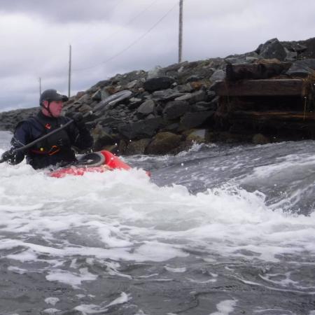
Lawrencetown’s point break has a few very nasty Riptides, especially on the ebb tide. If you find yourself caught in one of the rip tides swim, or paddle horizontally. I’ve personally been involved in the rescue of multiple people caught in these rips, so they should be taken very seriously. There are no sharp rocks, but at lower tide the waves can break against the rocks, which if you’ve flipped can result in some helmet/rock interaction.
The best access for the point break is parking at what we call the “Stony Beach” parking lot, this is the parking lot before the hill to the Teahouse. This is not the parking lot with all of the buildings. At high tide you can put in right in front of the parking lot, at lower tides you may have to walk towards the point a bit.
There are two primary breaks we surf, the best one is the point break, it’s also the bigger of the two. The point break lines up with the two windows at the top of the Tea House, which is the building on top of the bluff. There is another point break to surfers right if you position yourself about half-way out in relation to the second point this is where most of mid-sized waves break. The break-point changes based on surf conditions and directions. This break is best on a south swell.
The point break is frequented by Board Surfers, we’ve so far maintained a very good relaitonship with them. Please maintain it, and follow the basic rules of surfing. If you run into trouble keep your cool and apologize, also explain how you catch waves, and figure out a way to not interfere with the surfers. Often I just start surfing the foam-pile, letting the surfers take the majority of the shoulder rides.
| Class: SURF | Length: Park’n’Play |
| Location: Grand Desert, NS | Character: Tidal Race, Salty, Hole/Wave |
| Optimal tidal variance: Any | Tidal info: 2h20 before low tide |
This wave/hole is relatively safe, surfers right gets shallow and is slightly sticky, and you could hit your head if you were to capsize. The feature slowly becomes unsafe as it becomes shallow, the biggest risk is hitting the bottom.
Please be respectful of the road, and the nearby residents. You can park at the intersection east of the bridge and walk to the wave see the Google Maps Min
The feature starts forming around 2 hours and 20 min before low tide.
| Class: II/III+ | Length: Wooded River Run |
| Location: Sackville NS | Character: Low volume, wooded, gun range |
| Gauge: — | Contributor: Karl Vollmer |
The Sackville river isn’t run very often, as such there’s limited beta on down wood and other obstructions. The river is also extremly flashy, and pushes lots of wood into, and across the river. It is strongly suggested all blind corners are scouted by foot, as there are often over ten trees across the river creating river wide hazards at any one time.
| Class: III/IV | Length: Park’n’Creek |
| Location: Sambro, NS | Character: Short creeky, low volume |
This stream is very shallow, even when in full flood so there is a significant chance for rock contact if you capsize. It is only runnable during extreme rain events, as such it is very likely that wood and or debris have washed down and created strainers. There are also points along the run that often have rope tied between the shorelines, depending on the water level the rope may not be visible in a hole or wave. The entire run should be scouted before attempting.
This very short run can be accessed via walking trail along the side of the road. There is enough space for two to three cars to park in a small gravel lot at the trailhead.
This seems runable when the Sackville is at 1.75 or higher.
| Class: SURF | Length: Park’n’Play |
| Location: Seaforth, NS | Character: Beach break |
| Optimal tidal variance: Any | Surf info: Magic Seaweed |
This is a curved stony beach with a nice sheltered small break about 100ft offshore, there is a rip that can be used to get out. The biggest hazard here is surfers, as this is a popular location, and they use the wave differently than kayaks. Respect their rules, and be careful.
This is a popular surfing spot, and as such parking might be complicated. Please avoid parking in anyones driveway or in an unsafe way along the road. Surfers have damaged individuals cars who park on private property, so please be careful, and be friendly.
| Class: SURF | Length: Park’n’Play |
| Location: Seaforth NS | Character: Sheltered SE Point Break |
| Gauge: Surf Forecast | Contributor: Karl Vollmer |
This is a remote point, that requires you to walk and then paddle out to. There is very limited visibility from the road / other houses, so if you do get in trouble it is unlikely that anyone will see you. In a short boat the swim can be 20-30min from the break back to shore. There are a few rips, and they change based on the wave direction, however the consistent one is surfers right of the point. This rip can extend quite a ways out, past the initial break.
The point break can be accessed via a local trail along side the road. This is a narrow road, and there are houses along it so make sure that you park as far to the side as possible so that you don’t block the road. We currently have a good relationship with the locals, don’t spoil it.
The secondary break at the point usually only goes off on larger swell days, it has good shelter from the west wind. Check here when the waves are at least 2m+ as reported at lawrencetown.
The south shore stretches from Lunenburg area down past Shelburne. There are hospitals in Shelburne, Lunenburg, Liverpool and Bridgewater. SAR resources may be further away but Coast Guard response should be similar to Halifax area.
| Area | Character | Location | Level/Gauge Info |
|---|---|---|---|
| Medway | Remote, Pool drop | Greenfield NS | Water Gauge |
| Indian Falls | 15ft Waterfall | Indian Falls provincial park | Water Gauge |
| Ovens Tidal Race | Small Tidalrace | Lunenburg, NS | Flood tide |
| Cooks Falls | Multiple Ledge Drop | Bridgewater, NS | Water Gauge |
| North River | Creek, Slide | New Germany, NS | Water Gauge |
| North Branch LaHave | Pool Drop | New Germany, NS | Water Guage |
| West Branch LaHave | Pool Drop | Midville Branch, NS | Water Guage |
| Main Branch LaHave | Pool Drop | Northfield, NS | Water Guage |
| Gold Gorge | Gorge, Creek | Chester basin, NS | Weather forecast |
| Upper Gold | Falls, Remote, Flatwater | New Ross, NS | Weather forecast |
| Roseway | Urban River run | Shelburn, NS | Water Guage |
| Tom Tigney | Creek | Shelburn, NS | Weather forecast |
| Argyle River | Tiderace | Gleenwood, NS | Yarmouth Tides |
| Maggi Maggi | Park’n’Run | Mahone Bay | Weather forecast |
| Lantz Falls | Park’n’Huck | Williams Lake | Weather forecast |
| Mersey | Park’n’Huck | Keji National Park | MillFalls, NS |
| Petite Rivière | River run | Conquerall Mills | Weather forecast |
| Class: I - III+ | Length: 14km |
| Location: Conquerall Mills | Character: River run |
| Gauge: Weather forecast | Contributor: Lukas Dee |
The Petite is a short river that flows out of Hebb lake near Bridgewater. A short, slow moving section connects to Fancy lake. After the river exits the lake it flows through an old mill site in Conquerall Mills, where the Crousetown and Conquerall roads meet. From here the river is divided into three sections (upper, middle, and lower), access points marking the start of each section.
The upper section from Conquerall Mills to the Watermills Road is the longest, winding through 7km’s of forest and marsh. There are very few visible houses or cabins along this section, giving it a more ‘backcountry’ feel. This section contains lots of slow moving water as well as small class I to II- rips and rapids. Where the river meets up with the road again, a large pond like still water is formed by the dam from the old mill. The dam marks the beginning of section II.
The middle section is the shortest section, but also the steepest. Over the next 1.5km’s the river drops around 15 meters. Multiple class II rapids are connected by very short flatwaters. The last 500 meters are the most exciting, as a class II+ and III rapid (III+ at highwater) are connected by a longer section of fun boogie water. Once you have mastered or portaged the rapids, the river joins up with the road again and a small driveway bridge crosses the river. Brown Branch Brook flows into the river here. This is one of the access points and the beginning of the lower section.
It is easiest to put in on the pond on the other side of the road, and then slide through one of the three channels that go under the road. Make sure there is nothing blocking the exit before doing so. The lower section consists of long stretches of class I boogie, and one 500 meter stretch of still water. This section is great for beginners and first timers. As you get to the community of Petite Riviere the highway 331 bridge crosses. This is where the river becomes tidal. Shortly before the bridge, the Petite Riviere fire hall is located on river right. If the surf is up, continuing on underneath highway 331 and paddling for 1km across a small lake, will bring you to a narrowing where the river flows between the beaches of Sperrys and Rissers out into the ocean. Because the river picks up speed here, incoming waves will stand up taller and carry on up the river. There are some great rides to be had, and parking is available beach-side at Sperrys.
The Petite is a narrow river that is close to the ocean, meaning blow downs and sweepers are almost always an issue, especially on the upper and middle sections. Good scouting and boat scouting skills are necessary to avoid trouble.
The dam at Watermills Road looks like the perfect 8 foot boof, but the bottom is only 2-3 feet deep at medium to high flows. Nosing in at all will likely mean sprained or broken ankles and feet. It also has a backwash so if it is attempted safety needs to be set. It has been run successfully.
An ATV bridge crossing the upper section, and the driveway bridge at the beginning of the lower section will both become too low to paddle underneath and will need to be portaged. These can also be a good place to practice waiting to roll up, if you don’t want to walk around. Both cross deep enough water to safely roll.
The last rapid of the middle section is a tight boulder garden, where it can be quite easy to pin a boat. Scout well and set good safety.
The lower section passes many riverside cabins and houses. There have been ropes and lines tied across the river before, especially in a long left turn where the river flows around a pond.
Mills Drop:
At the put in of the upper section, the river flows between a large mill structure. There is a small slide like drop here that is very easily scouted from the bridge. At most water levels the drop creates a small ledge hole that isn’t retentive and can easily be surfed out of or into. To run this rapid you’ll need to walk up and over the structure on river left. Once on the other side follow an atv trail to the river and start your paddle off with a bang.
Four-wheeler Wave:
After Mills drop the river meanders its way through the forest, with the occasional class I rapid speeding things up. At the end of a long flat section through a marsh the river narrows and flows into a round pool where an ATV trail crosses the river. The trail has been built up so all the water flows under the small bridge creating some faster current. At medium to high levels a series of small green waves form here which can be surfed in river runners and canoes. The eddies on both sides are deep and strong, so this can often be a great spot to work on skills.
Wake Up:
The next three kilometers after Four-wheeler wave are slower, with scattered class I rips and rapids. A small horizon line stretches across the river shortly before the river joins up with the road again, you are at wake up. The final hoorah of the upper section is a series of small scattered ledges that form some nice eddies, waves, and holes. The top ledge is best run on the right as it’s deepest there. Boat scout for wood.
Watermills Drop:
Paddling across the pond, a very even horizon can be seen before the Watermills Road bridge crosses the river. An old mill building is on the right, and a small platform is built just before the horizon line. The drop here is a human built dam, and is approximately 8 feet tall. The bottom is shallow so this should only be attempted at high water, and by paddlers with a strong boof stroke. Lining the drop up is very tricky so scout carefully and take a peek behind the curtain to check for rocks and wood. Middle right is best. Portaging is easy on both sides of the river, although river right is shorter and more straight forward. It is also easier to scout and set safety on river right.
Log Jam:
After the Watermills Road a 250 meter stretch of class I boogie brings you to a split up section of river. A small class II- rapid makes its way around small islands and boulders. The right channel will lead back into the middle channel. The middle channel is the place where many trees get caught, hence the name. Scout carefully as the logs are very hard to see. Starting down the middle channel and instantly turning into the left channel will likely be the best route. Experienced paddlers should go first to make sure.
Vineyard 1:
A short section of flatwater after log jam leads you to the first of the vineyard rapids. A large flat rock at the top can be fun to rock spin. The second ledge consists of boulders that can cause minor pins, so stay right for the straight forward line, or shoot left for a large eddy. Another short flat and the river dives back into the forest on the right.
Vineyard 2:
As the river enters the forest and narrows it picks up speed again. As it turns to the left catch an eddy on river left to check for wood in the drop. Three boulders in the middle of the flow create fun fast eddies to catch, before you enter a small pool.
Vineyard 3:
The river exits the pool to the right and enters vineyard 3. This is only a short fast rip, but a nice standing wave across the width of the river is the standout feature. Not much eddy access, so catch on the fly, and watch for overhanging trees.
Vineyard 4:
A short right turn after vineyard 3, a boulder garden that is vineyard 4 leads into a large flat water. Small boulders make for fun and tricky eddies. Stay middle left to avoid scraping.
Kajtek’s Rapid:
After the vineyard rapids an open flat water, where a field on river right comes down to the waters edge, leads to another narrowing in the river. Leave lots of space between paddlers, as there is only a small eddy on river right to catch before the first of the ‘big two’. If unfamiliar, get out and scout from this eddy. Be courteous of the owners of the land and small cabin. Two ledges lead into a rock wall where the current splits. The river continues left but a lot of water gets pushed right into a swirly eddy. The left line is the easier one. A right to left diagonal leads into a somewhat sticky hole that can easily be punched with speed. Left to right momentum is key. The right line is narrow and only goes at higher water. Stay just left of the pyramid rock sticking out, and a strong left stroke will pull you through. The river flattens out again shortly.
The Meat Grinder:
After Kajteks, a flatwater pool leads into 200 meters of class I and II boogie water. If unfamiliar with the river, stay closer to the left shore as the boogie leads straight into the biggest rapid of the Petite, The Meat Grinder. As you pass trees on river right that have buoys hanging in them, look for a large somewhat washed out eddy on river left. Get out here to scout. A well worn portage trail will lead you directly to the rapid that is made up of strewn boulders that create multiple sharp turns, small drops, and pour-overs. Make sure to take a close look at the main s-turn move as there are often logs stuck there that can be hard to see. Following the main flow from river left, through the s-turn to river right, and staying middle, middle right for the rest is the most obvious and straight forward line. Taking the top drops on river right sets you up for a small boof that has caused a few backenders. This line avoids the s-turn. If portaging, go further downstream than you think. The boogie water after the rapid is shallow so getting back in after will save your boat some hurting.
Petite Wave:
After the Put in for the lower section (driveway bridge) paddle through a short section of class I. Where tree branches hang over the river from the left side, and a backyard comes down to rivers edge on the right, a VERY small river wide wave forms. The eddy service isn’t good, but when caught on the fly, it’s one of the best waves to learn how to surf on for a first timer.
Flat Water Drop:
At the end of the only still water on the lower section, a row of piled up boulders that are likely part of a man made dam create a small drop. The river right drop isn’t runnable unless water levels are extremely high. River left is a clean straight shot. A small wave forms at medium to high flows. At lower water a hole forms in the middle that isn’t an issue, yet can be a fun challenge to surf in and out of. This rapid has shifted at highwater, due to the loose boulders so lines may change. Boat scouting is very easy to do.
Risser’s Wave:
After Flat Water Drop the next 1.5km to the community of Petite Riviere are continuous class I to II boogie. Just before getting to the takeout a sharp left turn leads into a right turn. In the middle of the two turns a small drop creates a wave on river left with good eddy access. Risser’s wave can be a quite a rowdy surf depending on water levels. If you’ve got energy left, burn it here, you’re almost at the takeout.
Conquerall Mills (Upper Put-in):
At the intersection of Conquerall and Crousetown Road, the river passes through a mill structure and underneath the bridge. Getting in, in the pool above the bridge is easiest. Drop the boats here and then go to the Conquerall Mills Community Hall to park and gear up.
Watermills Road (Upper Take-out, Middle Put-in):
Where the Watermills Road meets the Italy Cross Road, an old mill building is right next to the intersection. There is a small gravel pull off here that will fit two cars. Make sure to park far enough off the road to not block visibility to the intersection.
Old Italy Cross Road (Middle Take-out, Lower Put-in):
Where the Italy Cross and Old Italy Cross Roads meet, Brown Branch Brook flows into the Petite. Putting in on the pond here, and sliding through one of the channels below the road is the easiest way to get into the river. Make sure to check if the channels underneath the road are clear of debris. You can park along the Old Italy Cross Road , just make sure to not block visibility for the intersection.
Petite Riviere Fire Department (Lower Take-out):
Ample parking is available at the Petite Riviere Fire Hall. Park Alongside or behind the Fire Hall. The general store across the street sells beer and lots of other post river goodies.
Sperrys Beach (Surf Take-out):
If the surf is good and you have decided to catch some waves, use the parking lot at the end of Drews Hill Road at Sperrys beach for quick and easy beach side access.
There is no gauge for the Petite. The Petite doesn’t have much of a headwater, so levels need to be gauged on amounts of rain in Bridgewater. The Lahave gauge can be a decent indicator, at 2.4m or higher the petite is likely at a medium level.
| Class: IV+ | Length: Park’n’Huck, Creek |
| Location: Lake William | Character: Creek |
| Gauge: Weather forecast | Contributor: Lukas Dee |
Lantz Falls is the only known rapid on Solomon Brook between the communities of Lake William and Farmington. Where the road crosses the brook, a small rapid begins to form and leads into a 90 degree turn. After the turn a “Fast and Furious” style slide with a few diagonal waves leads into a 10 foot drop. At the bottom of the drop is a deep pool that is followed by slow moving current. The slide is the most important part of the rapid as it
will either make or break you before going over the drop. Careful scouting is needed to hit the line. The drop can be run from river center to river right. On river left the water slams into a rock wall and would make for a very unpleasant experience.
Setting safety is only possible after the drop, meaning any mistakes before will likely end up hurting. Safety is easy to set up by the pool after the drop, although it requires climbing down a steep embankment which could also cause some problems in case of an evacuation. Good communication and a solid plan in case of emergency is highly recommended before running the drop.
Wood and strainers are also very likely as the brook is only about 3-4 meters wide in most places.
Park alongside the road. Lantz Falls is located 50 meters downstream and can be heard from the road. PUT IN
Park along the the road
There is no gauge for Lantz Falls, or Solomon Brook. This feature will only run after large rain events. If the Lahave River gauge is showing an increase in the river level of 0.75 meters or more in the span of one day, Lantz falls is likely runnable.
| Class: III | Length: Park’n’Run, Creek |
| Location: Mahone Bay | Character: Creek |
| Gauge: Weather forecast | Contributor: Lukas Dee |
Ernst Brook which is known to the locals as The Maggi Maggi, is a small brook that drains from Blockhouse into the Mahone Bay harbour. There is only one known rapid which is located 500 meters up from the harbour, where the brook drops into a small gorge. When there is enough water the many ledges turn into one continuous raging slide-like run that is approximately 50-75 meters long. A creekers dream. As the brook exits the gorge an old mill site creates a river wide feature that, at runnable levels becomes a surfable wave. Continuing down to the harbour is possible but the entire run would need to be scouted and cleared of any trees.
As this is a very small brook, any trees that fall in the river are bound to get stuck and cause major problems. Before running, the entire section needs to be scouted. Removal of trees is rather easy as the brook is so narrow, except for in the gorge where the vertical rock walls make it impossible during high flows. Some locals often check to make sure trees are not in the gorge before major rain events. When there is enough water for the rapids to be runnable, the sides of the brook will overflow in some places, eliminating most of the eddies. When scouting make sure to have a plan where to exit after the gorge after running the rapid.
Park here and walk south on the Bay to Bay trail. After about 100 meters you will come across a bridge that crosses Ernst Brook. A few large rocks next to the bridge mark the entrance to a wide walking trail that can be followed along the brook all the way to the main rapid.
PUT IN
Park along the the road
There is no gauge for Ernst Brook. There will only be enough water after major rain events where large amounts of rain (50mm+) fall in a short amount of time. It is only a 2 minute walk from the road, so checking it on the way to other rivers is not hard.
| Class: I - IV | Length: Park’n’Huck / River run |
| Location: Keji national park | Character: ledge drop |
| Gauge: Hydrometric | Contributor: Lukas Dee |
This river run / park’n’huck is located mostly in the Keji National park, as such you will need a park pass to enter during the operating season.
PUT IN
The put-in for the drop is just past the information center in the first parking lot.
The gauge is located just below the drop, and should be accurate. Anything under 1.0 is scrapy and can hurt as the rocks are really close to the surface but it has been run as low as 0.875, but it was bumpy.
| Class: II,IV | Length: ~12-30km |
| Location: Chester Basin NS | Character: Gorge, Constricted, Flatwater, Remote |
| Gauge: 40mm+ rainfall in New Ross | Contributor: Karl Vollmer |
This is a relatively remote run, and also a long one with some of the more significant rapids early on in the day. Risk assesments should be done as such. There is also spotty cell phone coverage, and even if you could reach help it there are no roads, and very limited quad trails to evacuate if needed.
First rapid, run right, at high water don’t go too far right or you might pin on right above the falls
Always go left along the far river left side, the main channel has two dangerous undercuts
Strait shot
Right branch, and stay right as there are some big holes.
Put-In
The put in is actually a nearly one km walk down an old abandoned road. Park at the base of the hill where it turns up towards the end of Glengarry rd. There will be an old overgrown road there. Walk down that and then when you feel like it bush-wack down to the Lake. You can also put in at the top of the lake, but that adds about an hour or more of flatwater to the day.
Take-Out
The shortest take out option is to paddle up into the swamp where the road meets the small stream, and then hike up the hill. This road is extremely poor, and should only be driven by high clearance 4x4 trucks. SUV’s are not sufficient. This take out creates about a 3-4 hour run with time for shuttle, the take out itself is sometimes hard to see
You can also take out at the normal gorge run takeout, but that’s about 8+ hours of paddling.
The gold river doesn’t have a gauge, so levels have to be guessed from rainfall, and general moisture in the ground. The water-source for the gold is up in New Ross so rainfall amounts in Kentville/New Ross can be used as an estimate. Usually 24-48 hours after heavy rain in Kentville the gold gorge will be up.
| Class: II+/III | Length: 8km |
| Location: New Germany/Barss Corner | Character: Pool drop, river-run |
| Gauge: Water Guage | Contributor: Karl Vollmer, Lukas Dee, Dave Dunne |
Put-In
Take Out
| Class: II+/III+ | Length: 11.5km |
| Location: Midvill Branch | Character: Gorge/Pool drop |
| Gauge: Water Guage | Contributor: Karl Vollmer, Lukas Dee, Dave Dunne |
The crux move of this river comes right after a easier double drop and at highwater can have significant retentive holes. There is minimal time between the two to recover and get out of the river so care should be taken at higher water levels, even if you’re planning on walking Kayak Falls.
There are also a number of trees in/near the river so blind corners should be scouted to make sure there isn’t new wood since the last flood.
Put-In
Upper Branch Rd Put in at the bridge, there is almost no parking available here, we were able to fit one car at the put-in. Take care to make sure it is all the way off the road, and not blocking the view from someones driveway.
Take Out
Cookville Provnicial Park. There is plenty of room for 2-3 vehicles here. The take out can be identified, as it is just after you pass a large house with solar panels on river left, with significant river infilling with rock, which is a striking difference from the normal shoreline.
Hirtle Falls II-
This is a serious of small Class II rapids with large boulders, as the water drops this could become more like going down a pinball machine.
Double Drop II+
After the right takes a lazy right turn just as you come out of the boulder garden there is a gentle double drop of about 1-2ft per drop. At mid-levels there were no observed significant hazards beyond shallow rocks. Pick your line and have fun
After a series of S-turns in the river comprised of small Class I/II rapids you wil come to a calm section with a horizon line. This is the Ledges. This rapid can be scouted from the road as you are driving up to the put in. At mid levels this is a realitivly safe 2-3ft drop/slide following by a 4-5ft drop. There are multuple lines available. There can be a significant consequence if you swim here as there are very few places to get off the river between Ledges and the crux rapid Kayak Falls. Care, and potentially safety should be setup.
This is a four ledge drop just after a hard right turn in the river. Each Ledge is 2-3 feet high with about 10-15ft between them. At mid-to-low runable levels there are multuple lines, with one of the safer ones being staying far river left all the way down. This should be personally scouted every time as depending on levers there can be significant partial or river wide holes. At the low end of runable there was a signifcant river right on the 3rd ledge with a boil line ~6ft away from the drop, this should be run with care.
Near the end of the run the west branch merges with the [Main Branch]/south-shore/main-branch/ at Darrs Falls below the only hazard in the falls and makes for a really fun finally to the run, especially at higher water
This uses the LeHave Gauge. At flood levesl the class of the main rapids significantly increase, as such significant care should be taken if you are running it at or near flood conditions.
| Class: II | Length: Park’n’Play |
| Location: Gleenwood, NS | Character: Tidal feature |
| Gauge: Yarmouth Tides | Contributor: Matt Delong |
As this feature is run on the ebb there is some risk of being flushed out into lobster bay, however there are numerous islands / locations to get off the water as you are flushed out. Proper group rescue skills and incident management should mitigate most if not all flushing risks. The feature only works as the water is starting to get shallow so there is some risk of hitting rocks near the eddy line on river left. If you paddle above the bridge pillars there is also potentially a significant risk of pinning especially in a sea kayak – due to it’s length. Care should be taken to avoid pin risks, and a pin kit should be available, and multiple group members should be comfortable with it’s use. Either eddy (especially river right) provides ample opportunity to exit the flow if swimming for experienced swimmers, but should not be depended upon.
Eddy access to the feature is best from river right however the preferred parking location is on the west side at the end of old oak road. As always please be respectful of the location and make sure not to obstruct the road or damage the surrounding property.
The feature forms during spring tides, the low tide level must be below 0.6m as measured from Yarmouth. The wave forms on the ebb ~3.5 hours after high tide in Yarmouth.
| Class: II/III | Length: Park’n’Play |
| Location: Bridgewater, NS | Character: Multiple ledge drop |
| Gauge: Water Gauge | Contributor: Karl Vollmer |
Cooks falls is a series of Ledges in close proximity. The primary hazards are holes on each ledge, and fishing gear on River Left during the fishing season. This rapid is easily scouted by parking in the parking lot and walking up and down the shore. At the levels we’ve observed river right has always been a safe path down. At higher levels a large hole appears on river left that looks retentive, and should be avoided.
The primary risk in cooks falls are the rocks in the bottom, it’s often shallow and on river right the final drop is deep but a large shallow rock is a few feet downstream, so if possible being upside-down should be avoided.
You can park your car in a parking lot across from Here. There is a slippery path down to the water there. There is a second area just above the falls that isn’t technically a parking lot, but you can drive up and drop the boats there to avoid the carry.
use the Lehave River Gauge. Its runnable above 1.3m with some scraping.
| Class: II,IV | Length: ~2km |
| Location: Chester Basin NS | Character: Gorge, Constricted |
| Gauge: 40mm+ rainfall in New Ross | Contributor: Karl Vollmer |
The top two rapids have very deep pools under them, which do technically have under-cuts, at high water levels they should be four to five feet below the water level, and less of a concern, but they do exist. There are also minimal places to rescue, or get out of the river after the top drop until the very end of the gorge – making for a very long and rough swim if you capsize early.
Put-In
Beech Hill Rd. There is a small pull-off and a path down to the water here. This puts you in above all of the main rapids, you can paddle down and then eddy out right right to scout the gorge before running it.
Take-Out
Old bridge Rd. This road is easy to miss so slow down as you approach, there is room for 3-4 cars at the bottom in a small parking lot.
The gold river doesn’t have a gauge, so levels have to be guessed from rainfall, and general moisture in the ground. The water-source for the gold is up in New Ross so rainfall amounts in Kentville/New Ross can be used as an estimate. Usually 24-48 hours after heavy rain in Kentville the gold gorge will be up.
| Class: IV | Length: Park’n’Huck |
| Location: Indian Falls provincial park | Character: 15ft waterfall |
| Gauge: Water Gauge | Contributor: Karl Vollmer |
The entire River middle to river left section of the falls has exposed rock, and an unfriendly ledge at the base. In addition to the unfriendly entry there is a small pocket that a kayaker could easily get trapped in at the base of the falls, during the summer at lower water swimmers get stuck in the pocket eddy. At high water it may be possible to exit without external aid. Shore safety including live bait is highly recommended when running this drop.
The drop should be run river right along the slide with some lateral momentum to avoid getting pushed into the small eddy pocket on river left
During the open season you can park your car at the parking lot less than 200m from the falls and walk in. During the off season, when the levels are likely to be sufficient for running the falls the gate to the park will be closed, so you will have to carry your boat about 500m down the road to access the falls. There is limited parking in front of the gate, room enough for 2-3 vehicles at most.
use the Lahave River Gauge. It is runnable above 2.1m
| Class: I - IV- | Length: 5km and Park’n’Play |
| Location: Greenfield NS | Character: Remote, Pool Drop |
| Gauge: River Gauage | Contributor(s): Karl Vollmer, Lukas Dee |
The Medway river is a series of pool drops with very few continuous rapids or hazards. The section normally paddled is between Greenfield Nova Scotia and Buggy Hole a few Km downstream. At Greenfield on river left there is significant concrete and re-bar from an old mill in the river. The suggested put-in is below this obstruction. You can put in under the bridge at Greenfield but should ensure that you do not approach river left.
Depending on the time of year there can be fishing gear in the river, wood eel weirs and fishing platforms have sometimes been left in the river creating strainers. Some of these features can take up most of the river. While you are often able to spot this hazards long before they become a problem, it’s advised on any blind rapids to scout ahead first to ensure new fishing gear hasn’t been placed in the river.
At Bangs Falls there is concrete and some wood on river left under the bridge. It’s advised to stay river right under the bridge. This hazard is easily identifiable from upstream, but care should be taken at higher water levels as a swim at Perfect wave above the bangs falls ledge drop could drift into this dangerous area.
Bear Falls is the next major hazard on the river, and one of the few higher classed rapids on the river. It has multiple lines during almost all water levels. Fishing equipment is sometimes placed in this area so it should always be scouted before running.
PUT IN
Taking care to stay to river right you can put in at the bridge in Greenfield, there are also numerous land-owners who have graciously allowed paddlers to launch from their river-side property in the past. Please contact local paddlers for more information.
DO NOT park in anyone’s driveway, or along anyone’s road. There have been issues where a paddlers car has obstructed access for emergency vehicles. Please reach out to the local paddlers for more information, and safe parking locations.
TAKE OUT
1 Hour Run: For a very short river run you can take out on right at Bangs Falls just after the bridge.
2 Hour Run: For a medium run you can take out after Bear Falls on river left. Do NOT approach Bear falls on river left as there is a large dangerous hole from river centre to river left. For all but experienced paddlers it’s suggested you portage around the falls from river right, and then paddle back over to river left below the rapid. There is a campground on river right which provides an easy portage path.
3 Hour Run: For a long run you can continue on from Bear Falls down to Buggy Hole about one km downriver. The take out is on river left in the pool just after the rapid where the road abuts the river.
4+ Hours Run: For a full day run you can continue down to Charleston, this lets you experience the following additional rapids. Little Salmon Falls, Rocky Falls, Black Rattle, Glode Falls, Poltz Falls, Hemlock Run, Salmon Falls, Island Falls, Salters Falls.
CKNS and MetOcean are pleased to offer Nova Scotia paddlers real-time water levels of the beautiful Medway River. The Medway River is a 75 km river in Queen’s County, with a medium-volume stretch of class II/III whitewater between Greenfield and Buggy Hole. This section is home to popular play features such as Perfect Wave and Fisher’s Hole, and well-travelled rapids Bangs Falls, Bear Falls and Buggy Hole.
The river level is measured in real-time using a custom made gauge built for us by our friends at MetOcean. The gauge uses satellite communication and ultrasonic technology to send data to the CKNS website conveniently available to you on your computer or smartphone.
The gauge was built by MetOcean engineer and local paddler Leigh Woltman . The gauge installation was aided by the generous volunteer efforts of local paddlers Karl Vollmer and Dave Dunne. In other words this is a community project that was completed by paddlers for paddlers, with generous help from CKNS and MetOcean!
The gauge is available at http://whitewaterns.ca/gauge/
Mountain Falls Class II+ @ Highwater
An easy class II rapid comprised of a series of wave-trains. This is the first rapid you meet after leaving Greenfield. Little to no manoeuvring is required. This rapid is formed where the river narrows and bends to the right. It’s suggested to stay River Middle as on occasion trees have been observed on the edges. There is one more unnamed section of Class II water after mountain falls. There are large pools in-between them allowing time to deal with any upsets.
Perfect Wave Class II-
This is a small ledge directly above the Bangs Falls ledge, within view of the Bangs Falls Rd. bridge. At all but the highest water levels this is only passable on river right. River left of this feature is a very large eddy. This feature is one of the three primary play-boating features on the river. At most levels this is a wave feature that can fit 3-5 play boats at one time with direct eddy service. The neighbouring eddy is very large and can easily hold 20+ paddlers unless the river is in flood.
This feature is not recommended for beginners as if you come out of your boat you will likely have to swim over Bangs Falls and then over another small ledge under the bridge. A swim here is not hazardous, but the nearest easily accessible eddy is about 30-40m downstream on river right.
Bangs Falls Class III-
This rapid is the ledge drop just above the Bangs Falls Rd Bridge. At any but very high water this feature is only passable on river right. Directly below this feature is a hazard on River left under the bridge, so even at high water this feature should be run on river right.
Bridge Wave Class II
This is a small ledge/constriction created by the bridge just below Bangs Falls. The wave can be dropped in on from above, or accessed from below by paddling up directly behind the centre bridge pillar. When approaching this from above care should be taken that you do not pass under the bridge to river left of the right-most pillar, as there is concrete/re-bar and other hazards on river left under or directly after the bridge.
This is the second common Play-boating spot, it’s easily accessible from above or below the bridge on either side. This feature is primarily a steep wave, but at some water levels you can get a small hole at the surfers left of the feature.
Fishers Hole Class II
About 75m downstream from the Bangs Falls bridge is another small ledge drop, with a small play feature in river centre. There is a wooden bridge leading out to the play spot, this bridge is not in the river and is not a safety concern, but allows you to easily access this rapid from river left.
This feature is a hole, at optimum water levels it is deep enough for loops and other advanced play-boating moves. Swimming here is low risk, there are small Class I/II waves directly below it before it settles out into a pool. There is a large eddy river left of the feature. If you do swim and fall below the eddy it’s easiest to take out on river left and walk back up, but it is sometimes possible to attain back up the river.
Bear Falls Class III/IV
The most significant safety hazard on the river Bear Falls should be approached with caution. There can be fishing platforms and gear placed directly below the falls so it should always be scouted by taking out on river right and walking through Bear Falls camp-ground.
The most common line is the Sneak Route located on river right between two small shrubs. This feature can safely be done by most any paddler it is very low risk and pushes you into the eddy on river right at the bottom. At lower water your boat can hit rock, so swimming could result in minor injury, but the entry for the line is very simple, and requires minimal manoeuvring.
There are multiple other lines between the Sneak Route and River centre that can be run depending on the water level. They should all be scouted and relevant safety should be set-up. River left should be avoided at almost every water level due to a strong and retentive hole extending from river centre all the way to the bank on river left. River centre’s holes can be retentive at some water levels so care should be taken when running the centre line.
Buggy Hole Class III
This feature is located a little less than a kilometre below Bear Falls where the river jogs to the right and then takes a hard left as it comes up against a large slab of rock that extends most of the way across the river. The easiest line on this rapid is to simply maintain a position river centre and punch through the various holes and wave-trains. None of these features are retentive, and it ends in a calm pool so even a swim down the centre of this rapid is nothing more than a roller-coaster ride. If you are off-centre to river right there are some large boulders which could be hazards, make sure if you are going to come in contact you lean towards the boulder to prevent any possibility of pinning. In past runs these boulders have had large pillows on them, but that may change depending on the water level.
There is a Class III ‘move’ that can be quite fun. As you approach the rapid charge river right aiming for the edge of the large rock forming the bend in the river. There is a small (4-5 boat) eddy behind this rock protected by a eddy fence that can be upwards of 2 feet tall. If done properly you will launch into the eddy dropping 3-4 feet. Exiting the eddy can be complicated as there is a large boulder directly below and it often has a very significant eddy fence. This move is so fun, often we portage back up to run it multiple times.
Little Salmon Falls:
After a longer section of flat water following Buggy Hole, the river flows between multiple little islands. The main current leads you to a small narrowing where the are a few standing waves and a rock wall on river left. The eddy that is formed by the rock wall can give good access for surfing the waves at the right level.
Rocky Falls:
Once you are through Little Salmon Falls, you will already be able to see the horizon line where the river narrows again. This is Rocky Falls, one of the longest rapids on the Medway. With good water reading skills this rapid can be paddled without scouting, although care should be taken as there are some large features towards the end of the rapid that can dish out a mean beatdown. River center is the most straight forward with some maneuvering. Scouting is easiest on river right.
Black Rattle:
After Rocky Falls a meandering section of river, leads to a left turn. A long series of standing waves and scattered boulders stretch approximately 250 meters down the river. This is the Black Rattle. No scouting is necessary as you will be able to see all the way to the flat section below. Some boulders turn into holes at high water.
Glode Falls:
About 1km down from Black Rattle is Glode Falls. As the river turns slightly to the right the road appears on river right. A small series of waves and rocks leads into a ledge where larger waves and holes are formed. Center-Right is the most straight forward where most of the water flows and with sufficient speed all features can be punched through. On river right there is a large boulder that looks like it forms a cool eddy to boof into, although after looking at it from below, you will be able to see a piton rock hiding just behind the boulder. It is known as Parrott’s Piton. This rapid will need to be scouted as there is a fishing station set up on river left, and fishing gear can find it’s way into the main current. Easiest way to scout is stopping on the shuttle drive as the road is next to the river here. If on the water, getting out on river left and walking along the road is also very easy.
Poltz Falls:
After Glode Falls a long paddle across flatwater, where snacks and good friends help keep spirits high, leads you towards a narrow section of river that splits as it wraps around an island. Both channels are fun yet quite different in character. River left is more mellow, although there are two ledges along the island that create eddies to hop into. They are similar to the Buggy Hole eddy move, but a bit smaller and more forgiving. At high water the eddies can become sticky holes. River right has more water flowing through it. Large standing waves and a few holes create fun features to either punch through or play in. At the bottom, the two channels merge back together and the river flattens out again.
Hemlock Run:
Two wide sections of river which are connected by a short burst of faster moving water as the river splits and narrows around another island. Not much of a rapid to speak of, but river right will be the shorter option.
Salmon Falls:
The second wide section of river will narrow again abruptly as it enters Salmon Falls. More standing waves form and become rather large in size towards the end of the rapid. At high water the river becomes quite confused as it flows out of the rapid, and can
easily catch out a paddler who has let his/her guard down too early. At lower water a large boulder sticks out at the bottom of the rapid and should be paddled by on river left.
Island Falls:
Shortly after Salmon Falls, the river turns right and narrows again. A long series of ledges and boulder gardens are split up by small islands in the river. As you enter the rapid there is a standing wave on river right that is super fun to surf. Eddy access on river right makes catching the wave fairly easy. Read and run your way down the rest of the rapids that stretch for about 750 meters when including the last two ledges that take you past Oak Island.
Salters Falls:
After you’ve paddled another section of flatwater, you will join up with road again where it crosses a small tributary over a bridge. The river narrows and flows over three main ledges. The first one leads into a large wave train where the paddlers with enough energy left can grab a good surf. There is a boulder towards the end of the wave train on river left that marks a large eddy where paddlers can take a look at the features ahead. As the wave train flattens out the river drops over the second ledge. This ledge is best paddled river center and the paddler should be ready to do some fast maneuvering to avoid multiple large and sometimes sticky holes. Paddling past the holes the last ledge creates a series of smaller and more confused wave trains. The takeout is now just a few paddle strokes away.
| Class: II+ | Length: 8km |
| Location: New Germany/Barss Corner | Character: Gentle, remote, river-run |
| Gauge: Water Guage | Contributor: Karl Vollmer, Christopher Ball |
At lower water this is a friendly river with only one rapid requiring some maneuvering, however at flood levels the river flows into the trees, and there are often trees that fall across the river creating significant hazards. Extra Care should be taken if it hasn’t been run in a while, or right after, or during flood levels. Scouting of blind corners should always be done. This river is also relatively remote, as there are few cottages along it’s banks, limiting access to help.
Put-In – Full Run
Cornwall Rd Put in at the bridge, there is no parking available here, the private land owner who owns the driveway doesn’t mind if you put your boat in, but do not leave your car here.
Put-In/Take Out
Half Run McKay Bridge. There is a larger shoulder here to park one vehicle, you can either put in or take out here
Take Out
Full Run McKeen Rd. There is plenty of room for 2-3 vehicles here. The take out is at a large tree with a rope swing.
Salmon Chute
The first drop of note on this run and should always be scouted. It currently has some sweepers just around the corner after the drop so care should be taken if you swim, to swim away from the sweepers. You can usually eddy out river right if you’re quick. This all changes when the river is in flood. After Salmon Chute there are a series of Class I / II Rapids before you come to McKay Bridge.
Just before McKay Bridge the river flattens out and has multiple paths. The first ledge after McKay Bridge has some fun play features at non-flood levels. After the ledges at Mackay”s bridge, there is a slow moving section that leads into Cabin Drop
Cabin Drop
Cabin Drop (fancy’s pool), which should be scouted to make sure it is still clear of debris is a strait-forward rapid. It is a center river smooth drop with fun pools and play waves below. There is a sneak route on the right if you want to avoid the larger waves. After Cabin drop there are a few Class 0/1 rapids before coming to the next named one.
Black Rattle
This rapid is hard to scout due to the treeline and comes up rather quickly as you are coming around a bend to the right. You go first river right over the first drop, but then immediately get river left, then center for the last part of the run. This is definitely the most fun run on the river, and takes some skill to line up as you can’t just let the river take you or you’ll be over some big ledges. When the water is high, the standing waves at the bottom are big. There are several places you can eddy out and play, but the current is strong when the water is high.
After Black Rattle the remaining river is Class 0/1 all the way to the take out.
| Class: III,IV | Length: Park’n’Play |
| Location: New Germany, NS | Character: Creek, Slide |
| Gauge: Water Guage | Contributor: Kelsey Thompson |
Nova Scotia has several North Rivers but New Germany’s North river takes the prise…for sweetest North river I guess. When all of the creeks in the Cobequid Mountains run dry many river running and creeking enthusiasts set their sights on the North. This short but quality run has it all, big water, a great slide, creek lines, and some nice beat down potential at high water. The various forks and channels make for a “choose your own adventure” style run that is sure to please.
The run starts off with a good sized rapid and a couple of nice holes to punch. Shortly afterward the river splits into two separate channels, the left more of a creek style slide and the right more of a river running scoot. Afterward the two channels reconnect before splitting again at the next drop. This time river right brings you to a tighter more technical section of small drops and boogie water while the left channel holds the runs crown jewel. On the left channel you’ll find one of the cleanest slides in the province that is good to go at almost all levels when run center left. The last rapid is a short ways downstream and has a hole in the middle that can dish out a mean beat down at high flows. Either than that is relatively straight forward. Take out after this rapid.
Low water– class III (Below 2.5) High water class III+-IV
Although more of a river than a creek the North requires solid river skills and the ability to read more difficult whitewater. All lines should be scouted, and care should be taken especially during high water.
Put In
North River The put in requires a decent amount of walking along a dirt road, so allow time for the hike in.
Take Out
North River Rd.. Take out on river left just before the bridge over North River rd.
Anything below 2.4 on the gauge is likely extremely bony, and lacks sufficient water for the slide. As the water level rises the mid-sections will become less bony, but the rapids will also get more intimidating. 2.45 is a good level for a intro creek run.
| Class: SURF | Length: Park’n’Play |
| Location: Lunenburg NS | Character: Small Tiderace |
| Gauge: Tidal | Contributor: Karl Vollmer, Simon Barter |
Tidal race next to Corkums Island is surfable in a longboat just south of Lunenburg on the way to the Ovens Natural Park. The wave forms about halfway through the tide, and works on mid to spring tides. The small wave can be surfed by sea kayaks on the south side of the rock that splits the channel indicated by the location. The Blue Arrow is the direction of the current on the flood and points to the location with small standing wave.
This is a very low risk tidal race that happens on the flood tide. If you swim it flushes to calm water inland. In the tide race the water is shallow so a helmet is a must and a tough paddle is recommended as you may hit some rocks.
PUT IN
Next to Garrets Cove where the water is right next to the road provides the best access to this feature.
Shortly after the tide starts coming in the waves should start forming up.
| Class: SURF | Length: Park’n’Play |
| Location: Seaforth NS | Character: Sheltered SE Point Break |
| Gauge: Surf Forecast | Contributor: Matt Delong, Karl Vollmer |
There are the remains of an old concrete structre just past Best Drop, especially at lower water levels, or when swimming these can present a hazard. Scouting is recommended.
After the cottage wave there is a Hydro dam that must be portaged around. make sure to give yourself ample time to exit the river before getting too close.
Below the powerline rapids there is often significant wood, and trees in the river so make sure to scout all blind corners before continuing.
PUT IN
196 Bowers Rd make sure that you don’t block the small rural road with your vehicle, or park on someones lawn.
TAKE OUT
Bowers Run II/III-
Just after the put in, this short rapid leads up to best drop, you can safely takes this on river right, with plenty of space for eddy turns, at higher water levels you can increase the complexity of this rapid by attempting to duck’n’weave through the larger boulders river center and river left.
Best Drop III-
Should be scouted, high water there’s a sneak route river left that becomes sketchy as water level drops. Main chute can be easily run strait center line or right a river-right lateral movement to jump into the eddy just below the falls.
Mill rapids II/III-
Nearly no consequence this small series of ledge drops of no more than a foot or two can be run almost any way river right of center, however above the last ledge you can practice a thread the needle by starting left, cliping the top wave and then catching the current towards river center / river right.
Cottage Wave II/III- (Park’n’Play)
This rapid is around a corner where the river drops over a smooth nearly river wide rock, it does create a small recirculation at the bottom of the rock, this has never proven to be highly retentive, but it can hold a boat for 1-2 seconds after capsize at lower levels, it’s easy to boof over, and at higher levels starts to turn into more of a wave and less of a hole.
Power line II
After Cottage wave you must take out before the NSPower Hydro dam, you can take out river left above it and walk around it. Putting in below it there is a small play wave river centre, it can be accessed via the eddy on river left via the very long seem, it can sometimes require a bit of practice to ride the seem all the way back to the centre of the river, this rapid continues until the Highway 103 Bridge. below the Dam the river will fork you want to take the far right channel first.
Stairway II
The rapids after the HW103 bridge, the river will fork just past the bridge, take the far left. There are sometimes small surfable waves with eddy access along this route, water level dependent, just keep your eye out and catch them as you can, none of them are road accessible and thus not listed as park’n’play, they are also primarily front-surfing only.
Harbour rapids II
Just before the Harbour the river will branch again into three sections, we take the centre branch as it has the most water, but there has at times been logs, or trees across this last section as it’s littered with rocks, so care should be taken and blind corners should be scouted especially after any flood events, or significant water level drops which may uncover previously submerged logs. This rapid is a series of wave trains, small drops and minor manoeuvring.
| Class: II,III | Length: Park’n’Run |
| Location: Sable River, NS | Character: Creek |
| Gauge: Weather forecast | Contributor: Karl Vollmer |
This is a small creek run with minimal hazards, beyond those normally found in a class II/III environment.
PUT IN
Park alongside the road and you can walk up to the top of the rapid via a trail running along river left.
This is a very flashy river, and is usually only up after heavy rainful. Best caught when traveling to/from Shelburn for other reasons.
The Eastern Shore lacks a large population centre meaning there is limited access to Hospitals or Coast Guard water resources.
| Area | Character | Location | Level/Gauge Info |
|---|---|---|---|
| East River | |||
| Musquodoboit | Pool Drop / Park’n’Play | Musqodoboit, NS | Truro Rivers & Rainfall |
| Liscomb | |||
| Long Beach | |||
| St Mary’s River | Water Gauge |
| Class: III,IV | Length: 3km |
| Location: Sheet Harbour, NS | Character: Creek, Drops |
| Gauge: | Contributor: |
| Class: II/III | Length: Park’n’Play |
| Location: Liscomb, NS | Character: Pool drop |
| Gauge: | Contributor: |
This river does not have a road access put in for a majority of the rapids on the lower section, and includes a significant amount hiking in order to access the rapids upstream. Otherwise the river has a collection of Class II and at least one Class III drop with sections of flatwater between.
There is a significant waterfall about 4km up the river from the highway, this at the level we have seen it appears unrunnable and if approached from upstream should be carried around.
Put In Liscomb River Trailhead
Take Out Liscomb River Trailhead
| Class: SURF | Length: Park’n’Play |
| Location: Chezzetcook, NS | Character: Point break |
| Gauge: | Contributor: Mike Malley |
Waves were meeting in the middle like two sides of a zipper coming together creating a larger mohawk of a wave, very shallow so wasn’t surfed during initial scouting session.
This is a remote point break, and has be reported to be very shallow.
Put In
Take Out
| Class: III,IV | Length: Park’n’Play |
| Location: Musquodoboit, NS | Character: Gorge, Tidal features |
| Gauge: Truro rivers & rainfall | Contributor: Karl Vollmer |
Nova Scotia has several North Rivers but New Germany’s North river takes the prise…for sweetest North river I guess. When all of the creeks in the Cobequid Mountains run dry many river running and creeking enthusiasts set their sights on the North. This short but quality run has it all, big water, a great slide, creek lines, and some nice beat down potential at high water. The various forks and channels make for a “choose your own adventure” style run that is sure to please.
The banks of the rivers are lined with trees, and can – especially at flood levels create significant, sweeper hazards. Complete scouting of the river should be done every time you run down it. There are plentiful eddies during all but the highest levels, so you should be able to progress down by stopping at eddies and scouting as needed.
In the Canyon on the lower part there is limited ability to exit the river should there be a need to due to the steep cliffs, and significant amount of private property. While some individuals do not mind us walking across their property I have been confronted on a few occasions when forced to take out in odd locations due to an incident on the river (unexpected swim).
PUT IN
Public access to this run is available via one of the three bridges, or at the dry hydrant on HW357. DO NOT BLOCK THE DRY HYDRANT .
The canyon part of the run can be accessed by the Highway 7 bridge, please do not park on the far side near the auto company as it makes it unsafe / hard for them to pull in & out of their driveway.
The medium run (including the canyon) can be accessed via the Rails 2 Trails path that goes over the old railroad bridge off of Park Rd (HW357). It is a bit of a walk to the bridge, but not too far, it can be a bit of a scramble down to the river. river.
The full lower Run can be accessed via Bayers Mill Rd just off of HW 357. You can put in along Cabin Lane just across the bridge, please make sure you park in such a way that you do not block anyone driveway, or make it unsafe for them to enter/exit their driveway. This put in also gives you access to Blue Falls Pool, which has a park’n’play surf wave even at the lowest water levels on river right against the road. This location is perfect for intro whitewater kayaking courses.
TAKE OUT
The take outs can be at any of the bridges listed above. If you go all the way to the bottom of the river then there are a few locations where the harbour appraoches the road, and can be used to get off without crossing private property.
There is no gauge for the Musquodobit river. You need to use the general water levels of eastern shore rivers. The water source for the river is around Truro so if there is a significant amount of rainfall up in Truro and the rivers are generally mid-level then the Musquodobit is runnable. It usually takes about 40mm in Truro to bring it up, and then an additional 10mm per day to keep it up.
Jam Falls
The topmost rapid usually run this is a simple class II technical rapid, even at high water levels there are lots of exposed rocks and a relatively high chance of logs across the river in locations. The put in for this rapid is at the Dry Hydrant along HW 357, make sure to never park there encase the Fire Department needs access to it. At the bottom of these falls on river right, next to the road there can be a small single boat surfable wave at mid-high water levels.
Blue Falls
Another technical Class II rapid that even at high water levels often has lots of exposed rocks, and a high chance of wood / sweepers. At the bottom of this rapid there is often an excellent surf wave at all water levels, This spot is also an excellent place for current work as there are large calm eddies on both sides and a large pool with minimal current directly below it.
Flat Pool -> Railroad Bridge Pool -> Graveyard Pool: Three long slow moving water points in the river back to back, this can take quite a while in a playboat to paddle along, there is little to no current and no features
Graveyard to Canyon Run: Just after the graveyard the river narrows significantly and at higher water levels you will get an exceptional wave train all the way through. As the water levels drop a few ledges will appear with very small safe holes. The one directly below the bridge eventually turns into a surfable wave with eddy access at low water levels. There are often trees on the edges of the river in the eddies, so care should be taken at flood levels.
B&B Wave
Directly across from a B&B, right before the river turns is an excellent surfable wave with eddy access on river left. The wave sometimes is large enough for two people. Care should be taken to avoid swimming here as there is a triple ledge drop with a hole around the corner from this feature. While there is time to swim to an eddy… there is only just enough time to swim to an eddy.
Tom Vaughan Falls
Directly after B&B wave there’s a series of three ledges with a large hole at the bottom on river left. The rapid should be run just left of center for the first two ledges, and then just a minor shift over to river centre for the last ledge to avoid the hole. The take out is directly after this rapid on river left. The bottom hole is surfable at most water levels, however the river is tidal at this point, so depending on the river level vs tide level the hole may be washed out, or more of a wave. The hole is the most fun at mid to low tides.
| Class: II/III | Length: Park’n’Play |
| Location: | Character: Play wave |
| Gauge: Water Guage | Contributor: Karl Vollmer, Mike Nev |
At extreme high water events the St. Mary’s River will have a riverwide play feature form.
Put In
Take Out
| Area | Character | Location | Level/Gauge Info |
|---|---|---|---|
| Folly | Remote, Canyon | Wentworth, NS | Water Gauge |
| Drysdale Falls | Park’n’Huck | Bailey’s Brook, NS | Water Gauge |
| Bass River | Creek | Five Islands, NS | Water Gauge |
| Chiganois River | Creek | Debert, NS | Water Gauge |
| Salmon River | Urban river | Truro, NS | Water Gauge |
| Class: IV-V | Length: |
| Location: Five Islands | Character: Creek, Remote |
| Gauge: Water Guage | Contributor: Kelsey Thompson |
The Bass River of Five Islands is the natural step up from the Folly River. Not to be confused with the Bass River of Bass River this class IV-V creek requires a little bit of work but the pay off is well worth it. The ideal time to do this run is in the fall before the snow hits because the put in road is often too soft and snow covered in the spring to make it close to the put-in. This doesn’t mean that it’s not worth going in the Spring, just expect to hike further than usual and bring a four wheel drive vehicle if possible.
When you make it to the put-in you’re greeted with a bridge and little sign confirming that you are indeed in the right place. Once on the river a short class one stint brings you to the first drop…which most people will portage although it has been run successfully. Scout and portage on river right when you come to a left hand turn with an obvious horizon line. This unnamed drop is about an 8 foot ledge with a really messy lip that is difficult to get a stroke in on and a nasty hydraulic at the bottom during high water. Next you’ll come to a few read and run drops before arriving at Crap Chute. Scout on river left when the entire river falls into a four foot wide slot, you can portage high up the bank on river left or seal launch from the ledge beside the drop.
Now you’re done with the manky drops and can really start enjoying the rest of the run as you float into Split rock; a drop that is split in two by a rock island and followed closely by a ten footer. Run both on river right but it’s worth having a peak first, scout on river left. After the ten footer is a small ledge, stay right on this one as well. The left slot looks great but lands on a rock that could make for a really bad pin and has made for some nasty pitons, right is a simple boof. Next up is the most continuous bolder garden section. Most of this is boat scout able with good water reading skills and lots of eddy hopping. Keep an eye out for wood as this is where most logs get caught up on the run.
Now you’re at the glory drops, As Good as it Gets and Three Blind Mice. These are the cleanest drops on the river. As Good as it Gets can be scouted on river left and Three Blind Mice is just that, blind! It is possible to scout on river right from about 100 feet up but it’s really hard to gauge what the drop is actually like from here. At low water you can scout from river left with difficulty but most people run it blind which I’d recommend. Stay tight to the right wall with some speed and boof, it’s all good!
After one more three to four foot ledge you’re done and can relax as you float a couple of km’s downstream to the take out. Be sure to take out at the first bridge that goes over the river. It is on someone else’s property so be courteous and park out on the main road. Paddling down to the second bridge seems like a more responsible plan since it’s on public land but there are several beaver dams on this section of the river and it’s a huge pain to get around them all!
If you’re styling the drops on the Folly (you don’t have to be running Toblerone and Face Plant) you’re ready for the Bass but be sure to bring a little extra safety gear because of it’s remoteness.
The run starts off with a good sized rapid and a couple of nice holes to punch. Shortly afterward the river splits into two separate channels, the left more of a creek style slide and the right more of a river running scoot. Afterward the two channels reconnect before splitting again at the next drop. This time river right brings you to a tighter more technical section of small drops and boogie water while the left channel holds the runs crown jewel. On the left channel you’ll find one of the cleanest slides in the province that is good to go at almost all levels when run center left. The last rapid is a short ways downstream and has a hole in the middle that can dish out a mean beat down at high flows. Either than that is relatively straight forward. Take out after this rapid.
Low water– class III (Below 2.5) High water class III+-IV
Although more of a river than a creek the North requires solid river skills and the ability to read more difficult whitewater. All lines should be scouted, and care should be taken especially during high water.
From Halifax – Take Highway 102 North to Truro. From there take Highway 104 West towards New Brunswick. Take the Masstown exit (exit 12), turn right towards Great Village on 4 west. Turn Left on highway 2 North/West towards Great Village/Bass River and stay on this road until you’re in Five Islands. Park on the shoulder of the road beside Taylor Lane, this is the take out. You may want to go up the road/driveway to get an idea of what the bridge looks like you’ll be taking out at. Once a shuttle is sorted head back east on highway 2 then turn left (north) onto New Brittan Road. This will continue to get smaller and smaller until it’s too soft/snowed in/crappy to go any further. (stay left at all forks) Park wherever you can find a spot and start hiking. You’ll come to an ATV trail on your left shortly after you pass a couple of outhouses on the right. This will take you to the put-in. Note: a good four wheel dive vehicle can make it to the ATV trail so be sure you don’t pass it!
From New Brunswick – Take Highway 104 East to Nova Scotia. Take exit 11.Turn right onto highway 4. Turn right on highway 2 North/West towards Great Village/Bass River and stay on this road until you’re in Five Islands. Park on the shoulder of the road beside Taylor Lane, this is the take out. You may want to go up the road/driveway to get an idea of what the bridge looks like you’ll be getting out at. Once a shuttle is sorted head back east on highway 2 then turn left (north) onto New Brittan Road. This will continue to get smaller and smaller until it’s too soft/snowed in/crappy to go any further. (stay left at all forks) Park wherever you can find a spot and start hiking. You’ll come to an ATV trail on your left shortly after you pass a couple of outhouses on the right. This will take you to the put-in. Note: a good four wheel dive vehicle can make it to the ATV trail so be sure you don’t pass it!
Great Village River Scribble Hill. This isn’t directly linked to the Bass but is in the area and usually a good indicator. Anywhere above 1.4 is run able but not ideal, 1.5 and higher is perfect.
| Class: III - V | Length: Park’n’Play |
| Location: Debert, NS | Character: Remote, Creek |
| Gauge: Water Guage | Contributor: Kelsey Thompson |
The Chiganois only has a few drops on it but they are some of the nicest in the province. There are two branches, both have been run but the west branch is the one you want to put on. Putting on the East Branch means dealing with almost no water for quite a while before reaching the waterfalls that are at the confluence. The best option is to put on the West Branch and then hike up to the waterfalls on the East Branch once you reach the confluence. It’s a short and easy hike and is well worth the effort, especially if there’s no snow in the woods.
Above the confluence the West Branch of the Chiganois has a few minor class II drops. Once you reach the confluence you can see the two waterfalls that you’ll be hiking up to. These two drops are about as clean as they come. The first is a 15 foot auto boof into a huge pool. The second is a smaller wider eight foot drop. After this drop the two branches meet and float downstream until you reach Sam Higgins Falls. This is one of the best sections of whitewater in the province. The falls consist of four main drops, each of which have a pool in-between them with each pool getting smaller the further downstream you travel. To scout/portage the falls get out on river left on the corner of the river bend. The portage is steep and can be fairly difficult, It’s possible to scout the fist two drops from river right as well.
The first drop is a small ledge and the easiest of the four. Boof on the right. The next drop is a slightly more complicated ledge that is best run on the left. From here many people portage the next drop. The entrance is a tight s-turn with a hole in the middle of the second bend. This is closely followed by an off vertical drop where the majority of the water pushes into a wall, this is the crux move of Sam Higgins. Once through this drop a short pool follows into the finale. A narrow entrance with vertical rock walls on both sides opens up into a great drop that is best run on the right.
From here you have a few kilometers of class I to paddle to the take out. Be aware that near the take out there has been barbed wire across the river in the past. This is located beside a cow field and can be difficult to spot so stay alert.
Difficulty: The majority of the rapids are class III-IV with the hardest being class V. Paddlers should carry all appropriate safety equipment for a more remote day as access to roads once in the river gorge can be difficult.
From Halifax– Take Highway 102 North to Truro. From there take Highway 104 West towards New Brunswick. Take the Debert exit (exit 13), turn right towards Debert on Macelmon Road. Turn right on Plains Road toward Belmont. Turn left on Belmont/Masstown Road, the river will be on your right. Turn right on Graham Road and park on the side of the road, this is the take out you should be able to see the river down a hill to your right. Drop a car here then continue up Belmont Road towards the putin. Stay right on Upper Belmont Road, turns to dirt road. Stay right at fork. Put in on tiny feeder creek, sometimes it looks like a ditch.
From New Brunswick– Take Highway 104 East to Nova Scotia. Take the Debert exit (exit 13), turn right towards Debert on Macelmon Road. Turn right on Plains Road toward Belmont. Turn left on Belmont/Masstown Road, the river will be on your right. Turn right on Graham Road and park on the side of the road, this is the take out you should be able to see the river down a hill to your right. Drop a car here then continue up Belmont Road towards the putin. Stay right on Upper Belmont Road, turns to dirt road. Stay right at fork. Put in on tiny feeder creek, sometimes it looks like a ditch.
Great Village River Scribble Hill. This isn’t directly linked to the Chiganois but is in the area and usually a good indicator. Anywhere above 1.4 is run able but not ideal, 1.5 and higher is perfect.
| Class: III,IV | Length: Park’n’Huck |
| Location: | Character: 40ft waterfall |
| Gauge: Water Guage | Contributor: Kelsey Thompson |
This 40 foot waterfall located on Bailey’s Brook is one of the cleanest in the province. Situated just around the corner from the Folly River this waterfall is an excellent addition to a high water run.
With very little Whitewater on the river other than the falls, Drysdale is the definition of park and huck, especially with a sandy beach to take out on and stairs cut out of the bank that take you back to the top. Just above the waterfall is a five foot ledge that is at 90 degrees to the main drop making the lead in a bit trickier.
Note: Although the falls have been open to the public in the past they have recently been closed because of people being disrespectful, leaving broken bottles and vandalizing property. The falls are on private property so if you plan on going to them be sure to keep a low profile and be respectful, especially in summer…the RCMP have given tickets!
From Halifax: Take Highway 102 to Truro, exit right (#14A) onto Onslow Street towards Tatamagouche. Turn left onto Route 311 North to the town of “The Falls”. Turn left and follow Route 256 to the bridge over Bailey’s Brook; back track and park on the side of the road just after passing over the river, there should be an old gravel pit on your right. From here there is a trail up to the falls, about a 5 minute walk upstream.
From New Brunswick: Take highway 104 to Nova Scotia. Take the Wentworth Valley Scenic Loop exit (# 7). Turn Left towards Ski Wentworth. Turn left onto Route 246 towards New Annan. Turn right onto Route 256. Drive past Willow Church Road then look for Bailey’s Brook.
Park on the side of the road just after passing over the river, there should be an old gravel pit on your right. From here there is a trail up to the falls, about a 5 minute walk upstream.
Use Great Village River Scribble Hill, this isn’t directly linked to Bailey’s Brook but is in the area and usually a good indication. Anywhere above 1.5 is run able but not ideal, aim to do this one at flood, the higher the better! This is checked hourly by @whitewaterns, if it’s up it’ll tweet about it.
| Class: III,V | Length: ~5km |
| Location: Debert, NS | Character: Remote, Creek, Waterfalls |
| Gauge: Water Guage | Contributor: Kelsey Thompson |
Nova Scotia has several North Rivers but New Germany’s North river takes the prise…for sweetest North river I guess. When all of the creeks in the Cobequid Mountains run dry many river running and creeking enthusiasts set their sights on the North. This short but quality run has it all, big water, a great slide, creek lines, and some nice beat down potential at high water. The various forks and channels make for a “choose your own adventure” style run that is sure to please.
The folly river is not run very often due to it’s rainy-season only good water levels, and higher technical level required for the run. As such there may be unexpected trees / wood in the river as it may have been more than a year since anyone has run the river.
Beyond normal hazards the remoteness of the river can make hospital access, or rescue more complicated. This river should be run by experienced paddlers with sufficient knowledge and gear to comfortably paddle Class IV/V rapids.
From Halifax– Take Highway 102 North to Truro. From there take Highway 104 West towards New Brunswick. Take the Folly Lake exit, turn left towards Ski Wentworth. You’ll pass a Cemetery on your right, this is the take out. Park on the shoulder of the road on the far side of the Cemetery to set up a shuttle. Just before you get to Folly Lake, turn right at the bottom of the hill. You’ll soon come to a bridge that goes over the river. This is the first put-in. For the second (more popular) put-in take a right just after the bridge down a road that follows the river. Park where the road forks and the better route turns 90 degrees away from the river and goes up hill.
From New Brunswick– Take Highway 104 East to Nova Scotia. Take the Wentworth Valley Scenic Loop exit. Turn Left towards Ski Wentworth. Pass Folly Lake and take a left to the put-in just after the lake before going up a large hill. (To get to the take out continue on the main road until you see a Cemetery on your left. Park on the other side of the road just before you get to the Cemetery.) You’ll soon come to a bridge that goes over the river. This is the first put-in. For the second (more popular) put-in take a right just after the bridge down a road that follows the river. Park where the road forks and the better route turns 90 degrees away from the river and goes up hill.
The Folly River is a class III-V creek located 30 minutes from Truro. The Folly’s easy access, straight forward lines, continuous white water and option to walk any drop are quickly making the river a classic run. There are two put-ins for the Folly, the first is directly below Folly Lake at the bridge that goes over the river and the second is just above the first major drop Grandfather Clock. The take out is the same for both of these. Most people choose to use the second put in because there is only one drop above it and a lot of wood that forces you to get in and out of your boat a lot. To get to the second put-in follow the road until you reach a culvert going under it. Then follow the small brook down the hill to the river where there is a mossy area perfect for getting in you boat.
Kelsey running Grandfather Clock on the Folly
Grandfather Clock
A short walk down to the river and the action immediately begins. The first drop, Grandfather Clock, is the perfect warm up and one of the nicest drops on the river. An s-bend with a few small ledges brings you to a 15 foot drop at the end with a deep pool. It’s possible to scout this drop before putting on. This drop is followed by a mellow but continuous section of white water where all of the drops are easily boat scouted and quite fun.
Ian running Toblerone – Folly River
Toblerone
The next significant drop is Toblerone, an almost pure balls drop that is rarely run. The river drops close to 25 feet with an angled rock wall coming down one side that leaves little room to get by. All the water at the bottom pushes into a cave below that would make for a very unpleasant swim. When you see a big horizon line and some mist you’ll know it’s this drop. Get out and scout on river left. To portage carry down over the rock ledge beside the drop. This is where the river gets really good! The rest of the run is super continuous and leaves your heart pumping and teeth showing. Boat scout this section, there are lots of eddies to catch, although it’s really tempting to bomb it. Once you come to a horizon line where you can’t see much you’ve arrived at S-Turn. Paddle this drop from right to left. The current hit’s a reactionary which turns you to line you un for the exit.
Kelsey passing the can opener – Folly River
Can Opener
The next horizon line has a large rooster tail sticking up in the center. This is Can Opener, scout on river left. This can be portaged around if desired. You can run this drop right or left of the rooster tail. From the bottom of Can Opener you can see the final drop, Face Plant.
Kelsey Faceplant – Folly River
Face Plant
Eddy out on river right to scout this drop. At lower water you can portage down the rocks beside the drop but at higher levels go down in-between two trees at the edge of the tree line. This drop turns 90 degrees at the top followed by a two tier slide that drops around 20 feet. Below Face Plant the river widens out and slow moving current brings you to the take out, an old bridge abutment. Take out on river right and follow the four wheeler trail back to the main road where you should have left you car.
The closest hydro data is in Great Village River Scribble Hill, this isn’t directly linked to the Folly but is in the area and usually a good indication. Anywhere above 1.3 is run able but not ideal, 1.4 and higher is perfect. This is monitored hourly by @WhitewaterNS
| Class: I,II+ | Length: 1,3,10km |
| Location: Truro, NS | Character: River Run |
| Gauge: Water Guage | Contributor: Mike Malley, Karl Vollmer |
A great beginner river, with enough play to make it interesting. The salmon river is a quick rising, and quick dropping river that runs through Truro NS. You can mix-and-match your run, making it as short or as long as you would like. There is some wood at the very edges of some of the corners, but even at high water it doesn’t normally extend more than a few feet into the river, and does not pose much of a risk.
The river can be shallow at some points, so be aware that your head might scrape the bottom if you flip and attaining up the river can be hard a times due to the lack of water to paddle in.
This river has minimal hazards until you get into town. In town expect garbage in the river which might create a strainer hazard.
There are varying runs, short medium and long available on the salmon.
Short Run (Blue) At mid water, this is a good run that’ll let you play on corner wave, train wave and brass monkey’s ghost. Put in at the Bridge on Valleydale Rd where it crosses the river. There is a visual river gauge under the bridge, to help you double check the water level(s) for the runs.
Medium Run (Yellow) At higher levels, you can head up and catch the Blackrock feature. Drive up Valley Rd from the bridge on Valleydale Rd until to come to a sharp left turn that climbs up hill this is the put in. This road is dirt/mud with lots of potholes, low clearance vehicles not recommended. At the corner there is an ATV trail that leads along the river follow it until it goes into the river. Put in here and paddle across to the other side where the ATV trail continues, follow it across the bend in the river to the beginning of this run.
Long Run (Red) This extra long run has only been done a few times, by Mike Malley. It takes a few hours, and is only really runable during very high water. Because it’s only run very rarely extra care should be taken for fallen wood, or other hazards. The third put-in is at the bridge on Riversdale Rd
Take Out The bottom take out is at Murray Siding, river right at the Salmon river rd. bridge . There should be enough room to park your cars on Old Courthouse Branch Rd.
Map
Mike Malley – Blackrock
To get to this rapid, put in at the medium put in point and then paddle across the river attaining as much as possible, on river left you should find an ATV trail. Hop out of your boat and walk along the trail until it crosses the river again. This is Blackrock rapids, there are various waves and holes some with eddy service some that are only catch on the fly. This rapid only comes up at high(er) water levels, but allows for a lot of different options to play most of which have eddy access.
Mike Malley on Malleys wave
This feature is on river right where the river takes a sharp turn to the right right after a hard left turn. The primary play feature on the Salmon, named after Mike Malley, this feature appears in various forms at the different river levels. In general there are at least two decent surf waves at this location. The top wave is larger and often requires you to get out of your boat and carry back up to drop in on it. At some levels you can manage to get up from an eddy on river left. The bottom wave at this feature is the one that is surfed the most, it has excellent eddy access river right just below the rapid. At higher levels the wave has a large amount surging / and a reactionary component which can make for a wild ride.
Named for it’s proximity to the train tracks this tiny feature with eddy service is on river left as the river lazily goes drifts to the right. At high levels the whole is retentive enough for minor play boating moves but only about one boat wide. There’s space for about 5 playboats in the small eddy. This feature exists at lower water levels, with a slightly less retentive foam pile
The rapid formally called brass monkey, has been renamed Brass monkey’s ghost as changes in the bottom of the river have warped and diminished the original feature. This series of waves, and minor holes is just above the take out at the bridge, as such you could do a form of park’n’play, if you’re willing to walk back up after every run. There is no eddy service for a majority of the waves here. The waves and wave/holes are decent for front / back surfing, however surfers should be aware that it’s very shallow, in this part of the river, while front surfing your boat may actually hit the sandstone ledge forming the feature as you surf down to the bottom of the wave.
Anything below 2.4 on the gauge is likely extremely bony, and lacks sufficient water for the slide. As the water level rises the mid-sections will become less bony, but the rapids will also get more intimidating. 2.45 is a good level for a intro creek run.
The Bay of Fundy is slightly closer to the Helicopter SAR resources, however the strong currents and lack of large population centres means there is limited access to Hospitals or Coast Guard water resources.
| Area | Character | Location | Level/Gauge Info |
|---|---|---|---|
| Tidal Bore | Large Tidalrace | Maitland, NS | Tidal Level |
| Walton Whopper | Standing Wave, Tidal constriction | Walton, NS | Tidal Source |
| Class: III Tidal Race | Length: 10km |
| Location: Maitland NS | Character: Tidal Race, No Exit, Warm |
| Optimal tidal variance:13m – 15m | Gauge: Low Tide+3h |
This is a very large volume, high speed, tidal race with very few exit points. There are also occasional logs/debris floating in the river as well as powered zodiacs during the tourist season. Separation from your boat and or lost gear are the biggest hazards. Always paddle with multiple people, and you should have a very strong self-rescue/roll. If you miss the take-out you could be on the water for significantly longer than expected, so you should have ample water/food to stay in your boat for 6 hours.
Shuttle Setup Time: ~45min
PUT-IN
Our primary put in is at the public park next to River Runners just past the town of Maitland. During the summer their parking lot can get quite busy, so they have asked us to park down by the basketball courts once we’ve unloaded our boats. At the very least park as far away from the building so as to not interfere with tourists and visitors to the small center. They have always been very friendly with us, please do as they ask so we can maintain a positive relationship. To put in follow the mow’d path up over the bank towards the wooden pier that stretches out onto the mud. We put in on the left side, usually dragging our boats past the grass and then using our kayaks like a sled and sliding them down the hill to avoid getting stuck in the mud.
TAKE-OUT
Our primary take out is at the green creek bridge on riverside road. just off of Pleasant Valley Rd. Just before the bridge the road widens and there is room to park 2-3 cars there. We have had gear stolen from this location so it is not recommended that you leave any valuables in your car parked here, and to make sure that you leave one person with the boats at the end of a run. If you get off the boar early you’ll have to slog through thigh-deep mud to get up the slope to the parked cars. If you wait long enough, especially on large tidal days you can paddle almost all the way to your car. Green creek can be hard to spot from the river if you’ve never been before so it’s always strongly encouraged that you paddle with someone who knows the river your first time. It can be identified by looking for a giant cannon up on the hillside Bore Left after anthonys nose, if you see the cannon, it’s time to get off the river.
Feature Start is 3 hours after low tide at Burncoat head
All tidal information is based off of Burncoat head tidal times. The tidal bore arrives at river runners about three hours after low tide at burncoat head. This can change by 15-30min depending on tidal range, wind etc. It is easy to tell if it’s already passed when you arrive as the river will increase in height quickly, and the current will be going inland.
Best conditions: Low river (late summer without recent rainfall), 14-15m tidal range, Minimal Wind. **
** In 2015 Leigh Woltman and Karl Vollmer paddled the tidal bore at the 18 year high, over 16m, it was a unique experience, which will happen again in 2033.
The tidal bore is a very fluid feature and must be timed very precisely. Each feature forms up and dissipates in 10-15min at any one location. You need to be in the right spot at the right time, as due to the current and size of the river there usually isn’t time to re-position once a feature has started. The larger the tide the short the time between features, generally. The below list is from tidal bore runs between 14 and 15meters. Different tidal variances and weather will cause the timing to shift, once you’ve run it a few times you’ll be able to just adjust on the fly.
Timing for hitting the features is listed below in Bore time, which is the number of minutes after bore arrival. When the bore passes you at the top of the river note the time on your watch and use it to plan your down-river progression. Positioning is relative to the ocean flow, not the river’s natural flow. When looking inland (upriver) Bore Left is on your left, Bore right is on your right.
B+0 – Bore leading wave, expert option is to wait Bore Left against the sandbar and ride the wave in 3-4″ of water. Quite risky as a capsize results in hard impact with sand.
B+10 – Small standing waves near launch site Bore Right, these do not always form
B+15 – Small standing waves near Bore Left where it opens into the basin, these form if there is currently a sandbar in that area, changes through-out season
B+20 – large circular eddy forms Bore left where it opens into the first basin, can be hard to time, but fun to spin around in
B+35 – Bore right standing waves should start forming on far right bank of open basin
B+45(ish) – After open basin waves turn to haystacks, move down and pause at top of narrow section (This is the Killer K) once you see the waves forming get in and enjoy the right (16ft vertical is possible, non-breaking so not scary!)
B+1hr20 – Killer K over next two turns later in sight of bridge you may get nice waves on either inside or outside of turn (left or right very much depends on sandbar alignment
B+1hr40 – Bore Left right after bridge where river turns sahweet wave forms, I’ve ridden this one for 20+ min
B+2hr – Across entire Bore, under the power lines across the river stuff is everywhere, enjoy
B+2hr30 – Bore left at Anthonys nose (in sight of power lines before next bend in river) giant eddy line can be super fun to power across
B+3hr00 – Head towards Green River (Bore left at bend in river by anthonys nose) you’ll see a flat area and grass with a river carved through it, head up that a ways until you hit the bridge (and road)
| Class: I – III+ | Length: Park’n’Play |
| Location: Walton Bridge | Character: Standing Wave, Tidal Constriction |
| Gauge: Burncoat Head | Contributor: Leigh Woltman |
This feature works on an outgoing tide, while there is some distance below this feature before the open Bay, rescue and safety should be discussed and set up ahead of time to prevent a swimmer from being washed out into the bay of fundy.
The bottom of this feature is hard, sharp rock, long boats that have struck bottom have had massive gouges cut in them, and even a rudder ripped off. Care should be taken especially as the water becomes more shallow. There is also evidence of construction materials from the bridge which may also be present in the water.
Later in the feature the hole can become violent and appears retentive, with large whirlpools forming below care should be taken to ensure proper safety, always boat within your limits.
There is ample parking alongside the road, and up the street a bit. Please avoid taking up the parking spaces at the Walton Pub so that local patrons can use them. Also please grab a burger, beer or beverage at the pub after, they’re friendly, they look out for us and have been very accommodating of our presence.
Tidal Range at Burncoat head is used. I would target spring tides to get a good ride. In general, it seems worth surfing when the Burntcoat Head high tide is 14 metres or better, 14.5 is best, 13.5 is doable.
12.4 metres high, falling 9.9 metres
A feature formed but it was very small and not fast. The top wave was the only thing surfable, but it quickly formed into a true ledge with a hydraulic that was too steep to do anything. The features got shallow very quickly. At this level the corner wave (middle wave) doesn’t form up before the top wave comes in.
13.3 metres high, falling 11.4 metres
Was able to get some surfing out of it, the waves are really small and hard to do anything. Pretty slow and got shallow quickly – maybe had 30 minutes of surfing before it was too shallow. No corner wave until later.
15.1 metres high, falling 15.2 metres
High volume feature. Took longer to form as the extra water depth likely meant it took longer for the water to fall to where it could feel bottom. Waves were big and challenging. Top wave was not accessible from downstream eddy, eddy fence was just too high, but several people carried around and got good rides.
14.1 metres high, falling 13.2 metres
Good surfing level
13.5 metres high, falling 12.2 metres
Was able to surf but not as exciting as higher levels
14.7 metres high, falling 14.4 metres
Good features formed up. Top wave closed off from bottom eddies early. Dave was out in whitewater boat actually got to work some features.
15.3 meters high, falling 15.9 meters
Large features formed up, too much current/water for shortboats to stay on the wave more then a second or two, did not test long boats, but they might have had sufficient speed.
Slack tide under the bridge is a little after Burntcoat head high water (10 20 minutes lag)
Generally arriving in Walton at Burntcoat Head high water gives time to gear up and then get in the water before the features start to show
It takes 45-60 minutes after Burntcoat Head high water for features to form, sea boats will be able to ride things first, probably another 20-30 minutes before short boats.
The pub next door appears to drain sewer directly into the river (is this legal?)
At neap tides, I would skip the Whopper, a feature seems to form but isn’t worth the drive for me
The rocks at the Whopper are very sharp. The bottom wave/then hole (the Whopper) gets shallower and shallower. Judgement has to be used when to stop paddling. Hitting your head would not be good, as the rocks take a lot of plastic off the sea kayaks when the make contact.